Why did you chose this city?
The reason why I chose to focus on Brooklyn is because it is footsteps away from our school campus in the DUMBO area.

What was the waterfront used from in the history?

In 1881, John & Charlie Arbuckle invented a machine that would ground, roast, and pack coffee into small bags for distribution. This innovative machine paved a way for the selling of coffee beans because roasting coffee beans at home would easily burn.
The waterfront was used as the main waterway for the Empire Stores Warehouse. Empire Stores Warehouse housed coffee in the DUMBO area.


What caused the change at the waterfront?
I am unsure of what caused the change of this waterfront but it may be due to the development of Brooklyn Bridge Park.
What are the new uses?

This area is now apart of Brooklyn Bridge Park and they have recently approved a revitalizing plan to incorporate the warehouse as it is considerably a historic preservation building.
What are the transportation systems and the access to the waterfront?
By Subway
By Bus
B25 at Fulton Ferry Landing
B63 in the loop road on Pier 6
B61 at Atlantic Ave. & Hicks St.
By Bike

Is there boat or water access?
Accessible by the East River Ferry & Water Taxi
(http://www.eastriverferry.com/)
(http://www.nywatertaxi.com/)
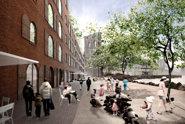
How does the waterfront attract people?


Due to the extraordinary view of the Manhattan skyline, visitors are automatically drawn to the day to night transition of our city.
What are the amenities?
-cultural museum
-office space dedicated to digital startups and creative firms
 -Brooklyn marketplace with local foods and restaurants
-public rooftop park
What type of retail/commercial/residential are at the waterfront?

380,000 sq. feet including:
-office space
-restaurant space
-commercial space
What type of public spaces are there?

Glass courtyard

Public Rooftop Park
Who uses these spaces?

This space will be used by local residences as well as tourist from around the world.

What is successful about this waterfront development?

I think that this new waterfront development will be successful because it embraces visitors to the site as well as the residences of the neighborhood.
What is not successful about this waterfront?
One con that may hinder progression is congestion in the area; e.g. Time Square, 42nd Street.
This is a very basic overview of our waterfront. There is so much information and you can visit it. There is a series of new developments that are completed and some that are in the planning stages. You will need to show these. Also you note that one con may be the congestion in Times Square? Times Square has no impact on the Brooklyn waterfront. Go back and look at the Brooklyn Bridge Park and look at all the developments that have been constructed and what are planned. There is so much information on this area. Try the Brooklyn Bridge Park website first.
ReplyDeleteI agree with Prof. Jill. What you are showing is not built yet. It is so close to our college, you need to visit. See how the waterfront is used at the moment. What did they do to bring people to the waterfront. Visit the Carousel that was designed by Jean Nouvel. It is a great example of waterfront revitalization, but you need more supportive evidence.
ReplyDeleteThe Brooklyn Bridge has such a huge impact on the site due to its close proximity that you should explore further the history of the bridge in relation to the buildings. Also you should probably look into other examples where public transportation has influenced in such a way the built enivornment.
ReplyDeleteMarianna Athanasiadou
Perhaps to help you keep track, you could start a land use analysis diagram (quick masterplanning), insert radial pedestrian distances ie. what does a 250m radius look like on plan at various nodes. That might help you sinking into the human proportions of the site. Remember to record 1) Built 2) Unbuilt & 3) Transit spaces. Keep up the great work!
ReplyDelete